


Table of Contents
- Introduction
- Importance of Sustainability in Urban Environments
- Understanding Geospatial Technology
- The Role of Geospatial Technology in Urban Planning
- Enhancing Sustainability through Geospatial Analysis
- Integrating Stakeholder Perspectives
- Conclusion
- Faq's
Introduction
Urban areas are complex systems that demand innovative solutions for sustainable development. Integrating geospatial technology into urban planning allows for informed decision-making, resource management, and effective problem-solving. By leveraging spatial data, urban planners can create resilient cities that meet the needs of both current and future populations.
Importance of Sustainability in Urban Environments
Sustainability in urban environments is crucial for addressing challenges such as climate change, resource depletion, and social inequality. Sustainable urban development aims to minimize environmental impact while promoting economic growth and improving quality of life. By prioritizing sustainability, cities can become more livable, resilient, and equitable.
Understanding Geospatial Technology
Geospatial technology encompasses a range of tools and techniques used to collect, analyze, manage, and visualize geographic data. It includes Geographic Information Systems (GIS), satellite imagery, remote sensing, Global Positioning Systems (GPS), and spatial data analysis. Geospatial technology allows for the mapping of physical locations, understanding spatial relationships, and making informed decisions based on geographic patterns and trends. It is widely used in urban planning, environmental monitoring, disaster management, transportation, and more.
 Understanding Geospatial Technology,GIA Navigator
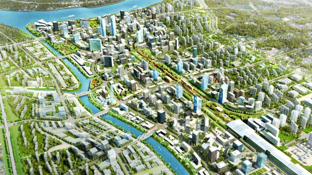
The Role of Geospatial Technology in Urban Planning
Geospatial technology plays a crucial role in urban planning by providing tools and methods to analyze spatial data and visualize urban environments. Key aspects include:
Mapping and Visualization: Geographic Information Systems (GIS) enable planners to create detailed maps that illustrate urban features such as land use, demographics, and infrastructure.
Data Analysis: Geospatial technology allows for the analysis of spatial relationships and patterns, helping planners understand trends in urban growth, traffic patterns, and environmental impacts.
Decision Support: By integrating various data sources, planners can make informed decisions about zoning, transportation, and resource allocation, ultimately promoting sustainable development.
Public Engagement: Interactive maps and platforms foster community involvement, allowing residents to visualize plans and provide feedback.
Environmental Assessment: Geospatial tools help assess the environmental implications of urban development, contributing to sustainable planning efforts focused on minimizing ecological impacts.
Infrastructure Management: Technology aids in the monitoring and management of urban infrastructure, including transportation networks, utilities, and public services, ensuring efficient operations.
 Urban Technology, GioInfotech
Enhancing Sustainability through Geospatial Analysis
Geospatial analysis enhances sustainability by identifying patterns, trends, and potential impacts of urban development. It helps in optimizing land use, reducing transportation emissions, and improving utility management. For instance, spatial analysis can reveal areas prone to flooding, guiding sustainable design in vulnerable regions. Overall, it fosters an understanding of how urban systems interact, leading to more sustainable outcomes.
 Sustainability Geospatial Analysis,Geospatial Studio
Integrating Stakeholder Perspectives
Incorporating stakeholder perspectives is essential for inclusive urban planning. Geospatial technology facilitates collaboration by enabling stakeholders to visualize data and engage in discussions about urban development strategies. Involving communities in the planning process ensures that diverse needs are met, promoting social equity and support for sustainability initiatives.
Conclusion
The integration of geospatial technology into urban planning is vital for fostering sustainable cities. By leveraging spatial data, planners can make informed, inclusive decisions that enhance urban resilience and quality of life. As cities continue to grow, adopting innovative tools and methodologies like geospatial analysis will be crucial for sustainable urban futures.
explore further
Latest from Contemporary ideas
More from Innovations
Resources


Dwello, for every home buyer, is a way to go from 'I feel' to 'I know', at no extra cost.